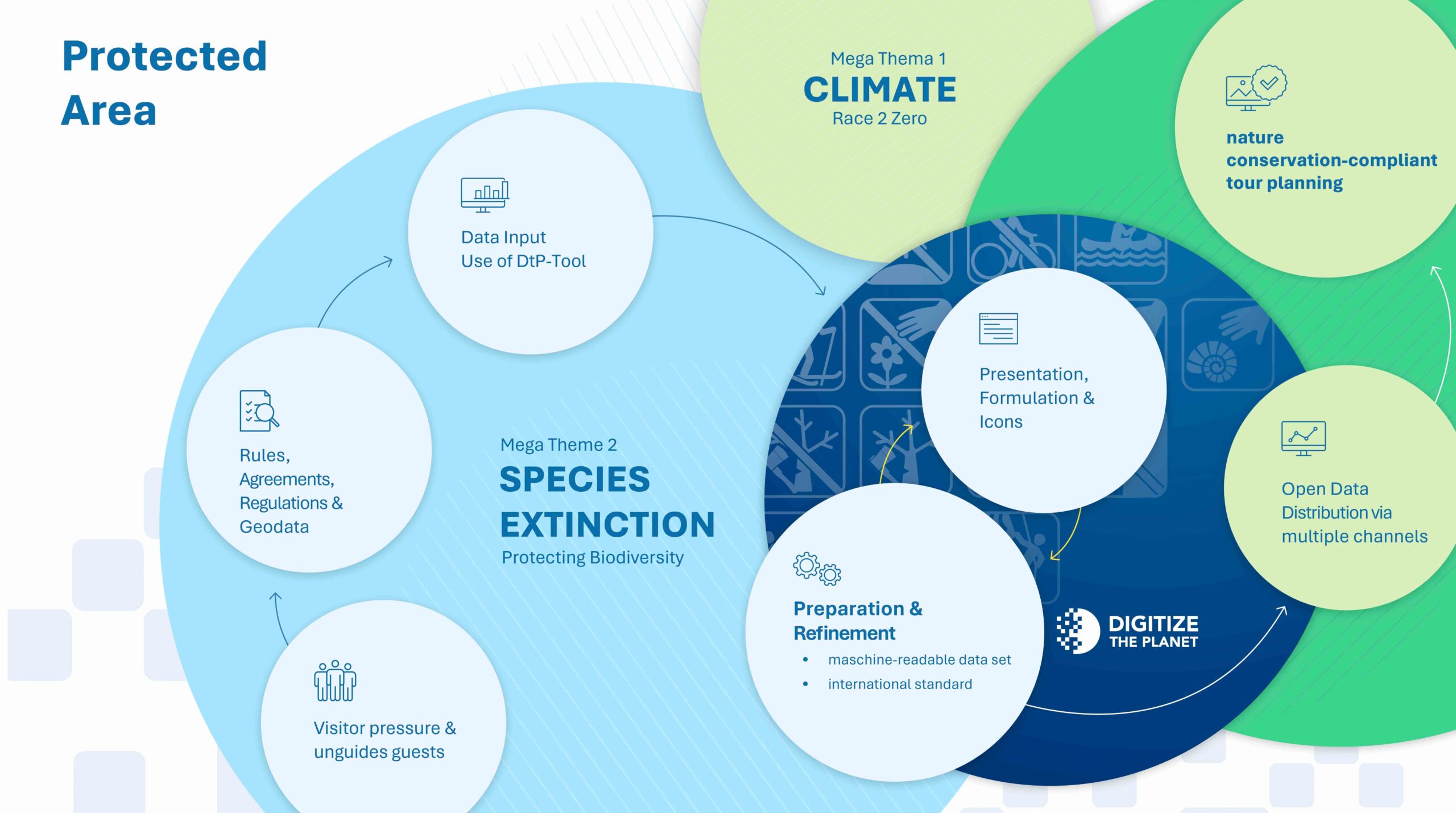
We create the digital basis for nature conservation-compliant activity management.

Digital and freely accessible information significantly reduces the pressure on protected areas. Digitize the Planet supports protected area administrations in the digital processing and dissemination of protected area boundaries, their rules including regulations, protection purposes and temporary closures. This enables digital and timely activity management right from the digital planning stage via tour platforms.
The Digitize platform is fully functional and only verified users can enter their data there. Use of the platform is free of charge. The digitized and georeferenced information is then available free of charge as open data.
Registration on the platform is open and not subject to any restrictions. Protected areas can be requested by the responsible persons and, after verification, can be provided with information on rules, protection purposes, images, legal bases, etc.
Data entry does not require any in-depth digital skills and is carried out using a simple input screen. Geodata on the areas is already available on the platform and does not need to be collected or processed independently. It is possible to have new boundaries integrated into the platform by DtP. We regularly offer free training courses on data input.
Georeferenced, standardized and machine-readable data in open data format is generated from the information entered.
Digitize the Planet provides the link via interfaces (API) to tour portals, map applications and other playout channels. This allows the data to be redistributed as open data. The use of this data is free of charge.

Best Practice
Karwendel Tirol Nature Park becomes a model region.
Best Practice
DtP is a partner of the Bergisches Land Nature Park.